
Point Nemo
- Assigned persons:
- 0
- Address:
- Point Nemo
- Political territory:
- null
- Coordinates:
- -49.026036072138,-123.43892998113
A pole of inaccessibility with respect to a geographical criterion of inaccessibility marks a location that is the most challenging to reach according to that criterion. Often it refers to the most distant point from the coastline, implying a maximum degree of continentality or oceanity. In these cases, a pole of inaccessibility can be defined as the center of the largest circle that can be drawn within an area of interest without encountering a coast. Where a coast is imprecisely defined, the pole will be similarly imprecise.
Oceanic pole of inaccessibility
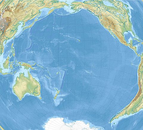
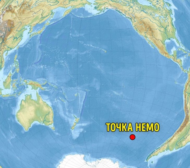
The oceanic pole of inaccessibility, also known as Point Nemo, is located at roughly 48°52.6′S 123°23.6′W and is the place in the ocean that is farthest from land. It represents the solution to the "longest swim" problem. This problem poses that there is one place in an ocean on earth where, if a person fell overboard while on a ship at sea, they would be at a point that is the longest distance to any land in any direction. It lies in the South Pacific Ocean, and is equally distant from the three closest land vertices which are each roughly 2,688 km (1,670 mi) away. Those vertices are Pandora Islet of the Ducie Island atoll (an island of the Pitcairn Islands) to the north; Motu Nui (adjacent to Easter Island) to the northeast; and Maher Island (near the larger Siple Island, off the coast of Marie Byrd Land, Antarctica) to the south. The exact coordinates of Point Nemo depend on what the exact coordinates of these three islands are, since the nature of the "longest swim" problem means that the ocean point is equally far from each.
The area is so remote that—as with any location more than 400 kilometres (250 mi) from an inhabited area—sometimes the closest human beings are astronauts aboard the International Space Station when it passes overhead.
Point Nemo is relatively lifeless; its location within the South Pacific Gyre blocks nutrients from reaching the area, and being so far from land it gets little nutrient run-off from coastal waters.
To the west the region of the South Pacific Ocean is also the site of the geographic center of the water hemisphere, at 47°24′42″S 177°22′45″E near New Zealand's Bounty Islands. The geographic center of the Pacific Ocean lies further north-west where the Line Islands begin, west from Starbuck Island at 4°58′S 158°45′W.
History
Point Nemo was first identified by Croatian survey engineer Hrvoje Lukatela in 1992. In 2022, Lukatela recalculated the coordinates of Point Nemo using OpenStreetMap data as well as Google Maps data in order to compare those results with the coordinates he first calculated using Digital Chart of the World data.
The point and the areas around it has attracted literary and cultural attention, and has become known as Point Nemo, a reference to Jules Verne's Captain Nemo from the novel 20,000 Leagues Under the Sea. The novel was a childhood favorite of Lukatela's, and such, he named it after Captain Nemo. The general area plays a major role in the 1928 short story "The Call of Cthulhu" by H. P. Lovecraft, as holding the location of the fictional city of R'lyeh, although this story was written 66 years before the identification of Point Nemo.
The wider area is also known as a "spacecraft cemetery" because hundreds of decommissioned satellites, space stations, and other spacecraft have been made to fall there upon re-entering the atmosphere, to lessen the risk of hitting inhabited locations or maritime traffic. The International Space Station (ISS) is planned to crash into Point Nemo in 2031.
Sources: wikipedia.org